5 and 2: Evolution and Generation of Land Use Diversity
 These Sustainability Issues investigate the spatial
clustering effects of combining a range of economic, social and residential
functions in close proximity. In particular we addressed the concepts of the
compact city, and the higher densification of land and space use and the
consequent intensification of social, leisure and employment activity e.g.
visitor/night-time economy, live-work and the mixed design of buildings.
VivaCity2020 researched the extent to which a concentration and diversity of
activity and uses produced positive and negative impacts for residents and
businesses, and the attitude towards mixed use/higher density from the
development sector.
These Sustainability Issues investigate the spatial
clustering effects of combining a range of economic, social and residential
functions in close proximity. In particular we addressed the concepts of the
compact city, and the higher densification of land and space use and the
consequent intensification of social, leisure and employment activity e.g.
visitor/night-time economy, live-work and the mixed design of buildings.
VivaCity2020 researched the extent to which a concentration and diversity of
activity and uses produced positive and negative impacts for residents and
businesses, and the attitude towards mixed use/higher density from the
development sector.
Case Studies
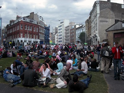
A pilot case study which served as the conceptual and empirical model, was undertaken in the Clerkenwell area in the city fringe of London, an archetypal urban village. A comparative case study was undertaken in central Sheffield where new apartments and mixed-use developments were underway, with further secondary analysis of residential surveys of central Manchester. In depth household and business surveys were undertaken and interviews held with local authority planners (policy and development control), conservation and economic development/ regeneration officers, local estate agents, developers and design firms. The purpose of the case studies was to measure the quality of life actually experienced and the decision-making rationales used by stakeholders.
Methods
Following a literature review on the concepts, public policies, guidance and evidence to date, case study selection was based on comparative changes in densification in England, and examples of mixed use development and intensification in inner urban/fringe locations. Detailed mapping (in GIS) of spatial data on the land use, economy, movement (axial, pedestrian, road) and recorded crime, highlighted concentrations of activity, which was used to inform both the user surveys and models of ‘mix-useness’. Engagement with development sector bodies including BURA, Mixed Use Forum, British Council of Offices, RIBA, developers and agents provided a sounding board for problem definition and research design.
Findings
Key findings concern the scale at which diverse social and economic uses can co-exist and the extent to which mixed use works at building/block, street and neighbourhood level. Spatial separation of some activities is still preferred albeit within walking distance, i.e. residential and nigh time activities, but apartment living above ground floor retail and some hospitality/entertainment uses is feasible, if design quality (light, soundproofing) and other conflicts of usage are managed. Prime quality of life problems were environmental – litter/waste, noise, anti-social behaviour. Crime hotspots (robbery and theft/damage to vehicle/bike) were associated with café/street culture in proximity to residential blocks and partially permeable street access, but also to fringe streets with poor natural surveillance (robbery/theft). Residents made trade offs between a lack of internal and garden/balcony space and views, and reduced car use/parking and access to public transport (connectivity). Amenities such as local shops, park/play space, were key quality of life requirements, but planning guidance and financial models to support mixed economy development were needed. Social mix was not just in terms of tenure/income, but also those familiar with inner city/denser living and those moving into these areas for the first time, with some evidence of estate agents mis-selling the cosmopolitan experience to those (younger couples/singles, and early retirees) not aware of the customs and impacts. Design solutions were found to be lacking - despite the policy panacea of mixed use, high density, compact development - with architects and developers seeking detailed guidance on: what mix of activities and layouts actually work and why, and planners and policy-makers: what social and economic mix is sustainable and at what spatial scale, and generally how can urban carrying capacity be measured at various scales.
![]() Click here for a list of Sustainability Issue Two and Five's Academic Publications.
Click here for a list of Sustainability Issue Two and Five's Academic Publications.
Tools
![]() Bibliographic Review
Bibliographic Review
Researchers from Sustainability Issue Two compiled an extensive
collection of references used throughout the VivaCity2020 Project.
Organised by theme and including books, websites, journals and
conferences, the Bibliographic Review is a valuable resource to those
interested in the work conducted by Sustainability Issue Two.
Extensive case studies were conducted in Clerkenwell, Manchester and Sheffield looking into the generation of land use diversity. Encompassed within these case studies can also be found information about the results of the Business and Households questionnaires.
The Decision-Making Process has developed a set of stages and tasks surrounding an urban development project. Sustainability Issue Two is not confined to a single development or urban design area scale. It also addresses the design of cities as a whole as well as in component parts. The planning stages and scales at which this operates are mapped onto the urban design decision-making process model.
This detailed presentation uses Space Syntax to answer the question: Are there spatial correlates to residential property values? Council Tax Bandings were investigated, along with locational variables, age, property size and ambient density.
This detailed presentation looks into the Space Syntax Theory of Centre Formation, examining the formation of city centres. The presentation outlines centre expansion and variety, and compares different high streets using graphical representation and statistical analysis.
A spatial data-based tool to map economic, social and land use diversity has been developed using the pilot Clerkenwell area test bed. Detailed analysis was undertaken to map and model the case study area using primary and secondary digital data in GIS format.
Household Surveys: A questionnaire survey assessed liveability and living situation in terms of location, building mix and layout, along with the aspects that residents liked or disliked about their neighbourhood. Business Surveys: This survey sought to assess the benefits of locating within mixed use and diverse environments from the perspective of trade, supply chain links and employment.
